China Geography, Maps, and Provinces Handwritten Newspaper Topics
Need to make a China Geography, Maps, and Provinces Handwritten Newspaper poster? Find topic options, copy references, section ideas and layout suggestions.
Topics you can use
How to Make a Handwritten Newspaper on Chinese Province Abbreviations and Capitals Easy to Remember
A handwritten newspaper about Chinese province abbreviations and capitals works best when it combines map reading, grouped facts, memory aids, and a clean layout. Instead of filling the page with too much information, focus on useful province examples, clear labels, and easy-to-read sections for students.
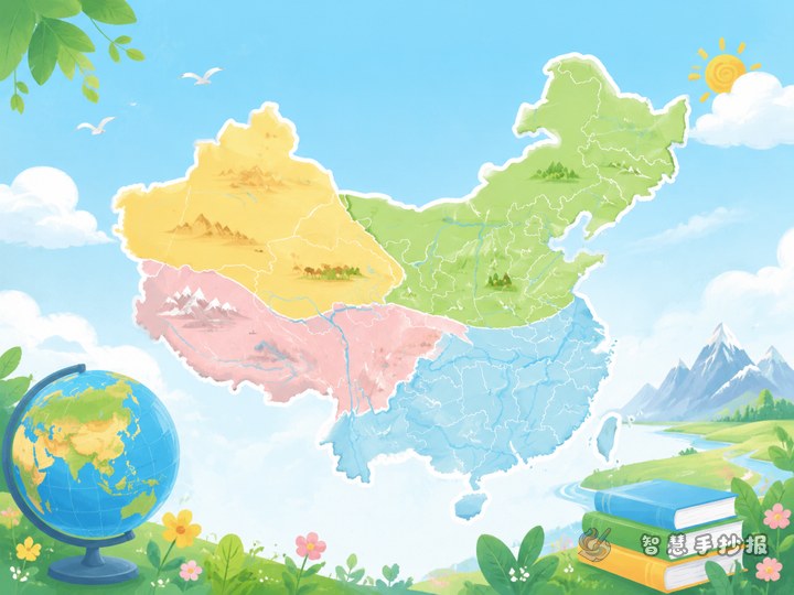
What Can You Write in a Handwritten Newspaper About China’s Four Geographical Regions?
A China map handwritten newspaper does not have to be only about listing provinces. Using the four geographical regions as the main theme helps students organize landforms, climate, scenery, and representative areas more clearly. It is practical for schoolwork and easy to design.

How to Write a Handwritten Newspaper About Which Chinese Provinces Border Each Other
This topic article focuses on a China map handwritten newspaper about neighboring provinces. It includes a center-map layout idea, short text materials, representative examples, direction-word practice, and design suggestions to help students create a clear and engaging geography poster.
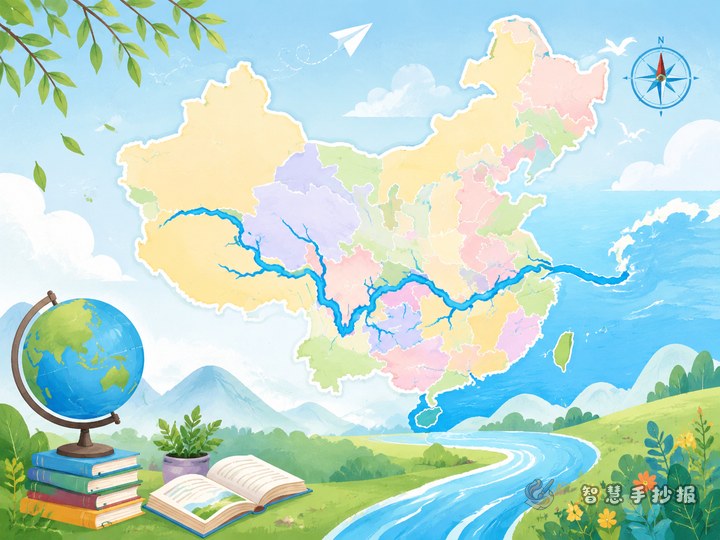
How to Make a Poster About Provinces Along the Yangtze River
A poster about the provinces along the Yangtze River is a clear and creative way to combine a China map, provincial facts, city features, and river knowledge. This guide offers section ideas, ready-to-use writing material, map labeling tips, and layout suggestions for students.
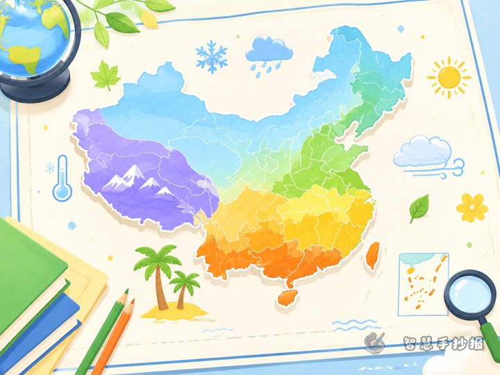
How to Design a China Climate Zones Handwritten Newspaper
This topic suggests a more creative way to make a China map handwritten newspaper by focusing on climate zones. It combines map coloring, example provinces, short facts, and layout ideas to help students create a clear and interesting geography-themed poster.
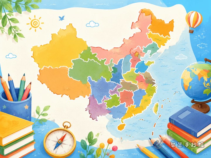
How to Make a China Provinces Map Poster in a More Creative Way
This topic shows how to create a China map and province knowledge handwritten poster with a travel-style angle. It includes section ideas, ready-to-use text, layout suggestions, and simple tips that make the poster clear, creative, and easy for students to complete.
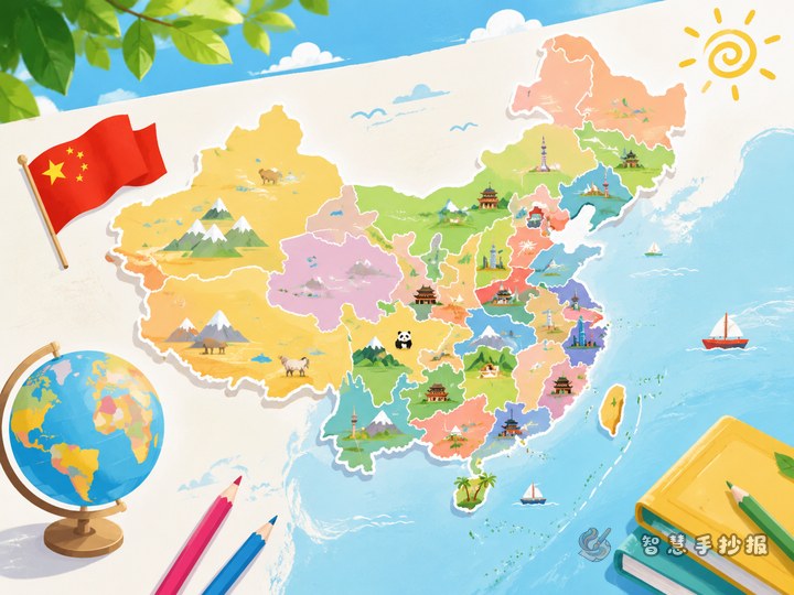
How to Make a Clear China Map Handwritten Poster
This topic helps students create a China map handwritten poster by using a centered map, region-based province sections, short geography facts, and simple coloring ideas. It is practical for parents and teachers to use as a quick reference.
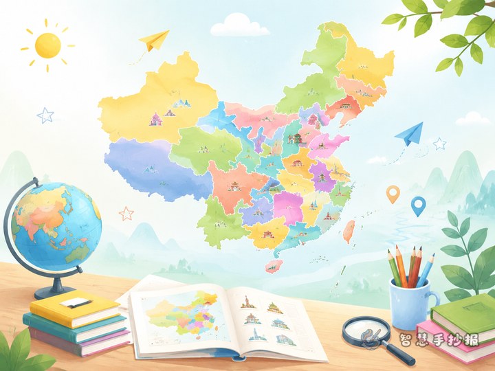
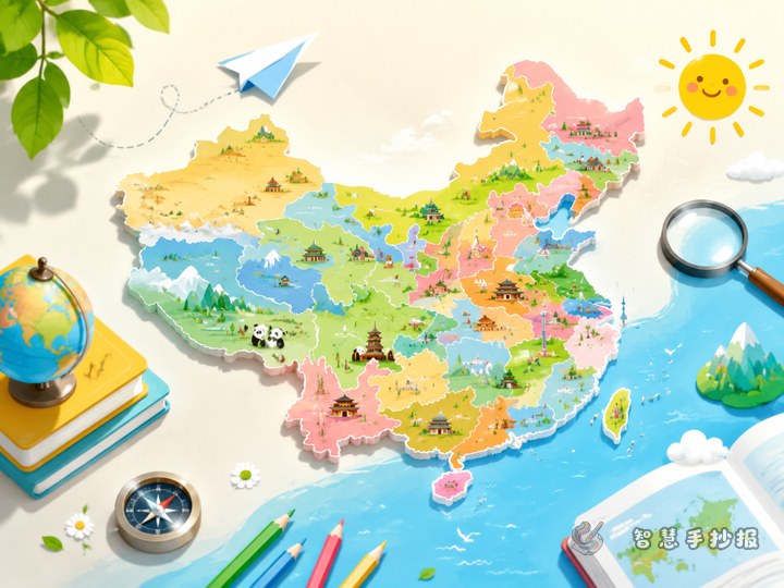
How to Make a Handwritten Newspaper About China’s 34 Provincial-Level Regions
A good handwritten newspaper about China’s 34 provincial-level regions should not be overcrowded with facts. The best approach is to combine a central China map with sections on region groups, abbreviations and capitals, key province facts, and simple visual design so the page looks clear and easy to read.
Want to create a poster now?
Scan with WeChat, enter this theme, and generate the layout, section copy and line art.
 Scan with WeChat