Start with two easily confused words: lithosphere and asthenosphere
Many students draw the crust, mantle and core and stop there, missing the layer that actually lets the plates move. Explaining these two words first gives your whole page a clear thread.
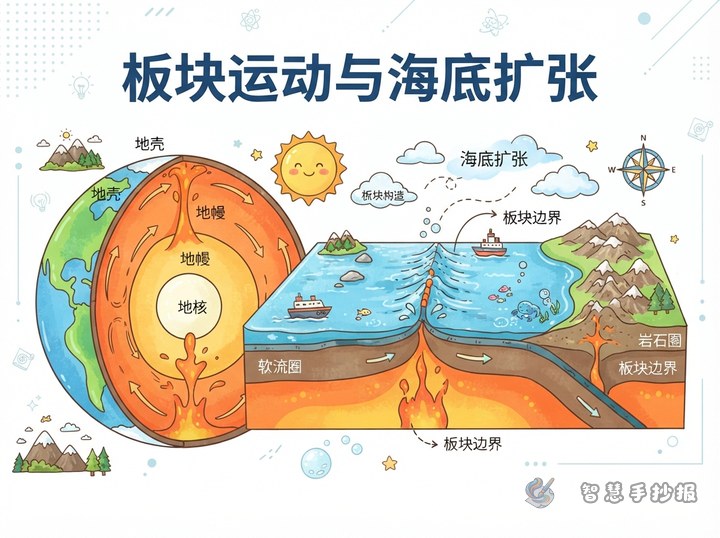
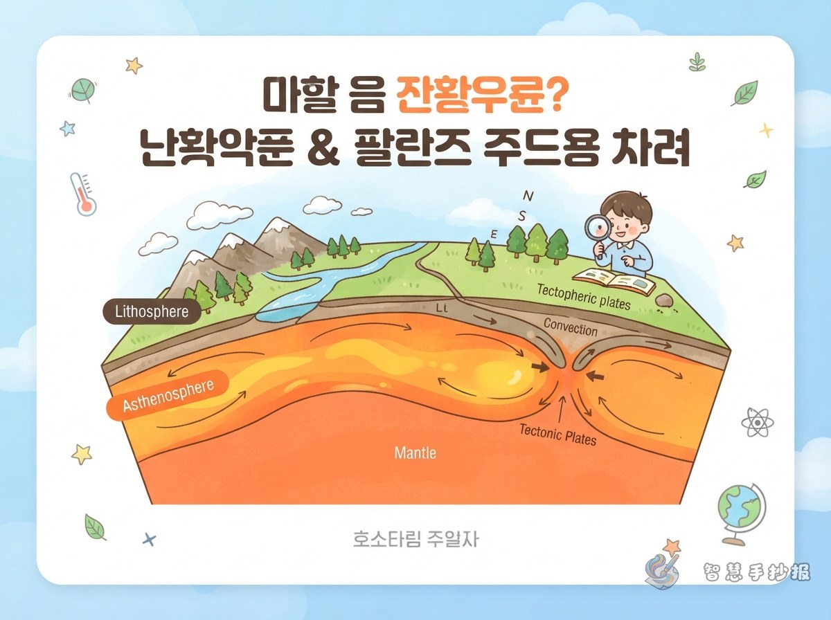
- Lithosphere: the crust plus the top of the upper mantle. It is hard and brittle, and it is broken into puzzle-like pieces — the plates.
- Asthenosphere: the hot, nearly molten upper part of the mantle. It flows very slowly, like thick syrup, and acts as the moving cushion under the plates.
A simple comparison works well in the margin: the lithosphere is like brittle crackers fitted together, and the asthenosphere is the slow-moving syrup underneath them.
Why plates move: let three sets of arrows do the work
The asthenosphere creeps along, carrying the plates above it roughly a few centimetres a year — about the speed at which your fingernails grow.
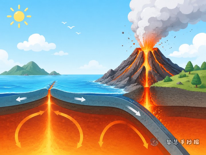
- Step one: heat inside the Earth makes material in the asthenosphere rise and sink, creating a very slow flow.
- Step two: that flow drags the plates above, so neighbouring plates pull apart, push together or slide past one another.
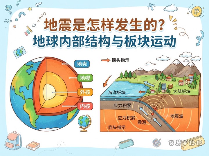
- Step three: once plates move, mountains, ocean trenches, volcanoes and earthquakes appear along their boundaries.
Use red arrows pointing up and blue arrows pointing down to show the flow in the asthenosphere, then stick black arrows on the plates to show which way they travel. Add one short line: "Plates do not wander on their own — they are carried by the slow flow below."
Columns that fit neatly on the page
Four or five sections are plenty. Give each one a short explanation so the page stays readable.
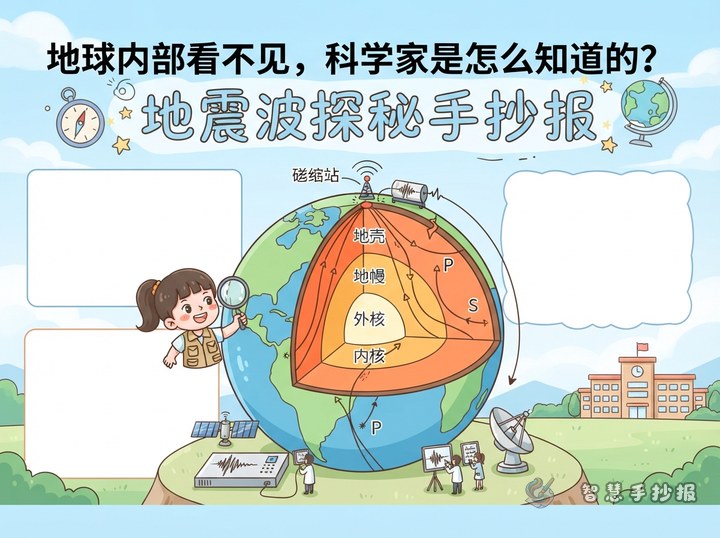
- Word cards: crust, mantle, outer core, inner core, lithosphere, asthenosphere — one sentence each.
- Speed comparison: plates move a few centimetres a year, about the same as growing fingernails.
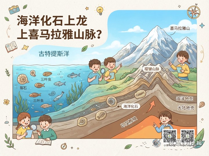
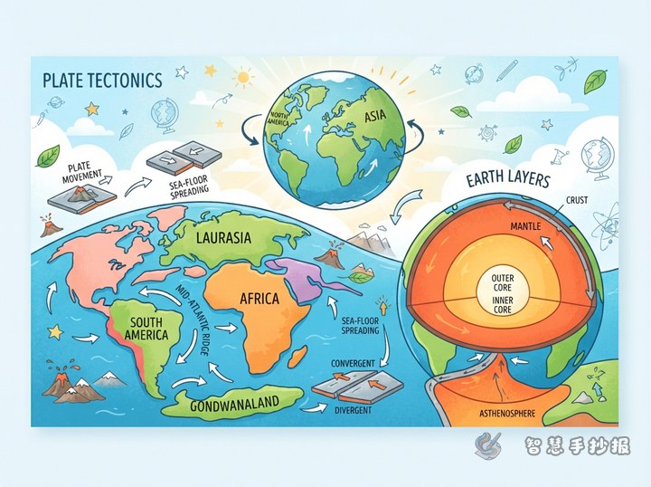
- The three boundary types: plates pulling apart create rift valleys and mid-ocean ridges; plates pushing together create mountains and trenches; plates sliding past each other bring earthquakes.
- Why it matters to us: most volcanoes and earthquakes cluster near plate boundaries, which is why some regions shake far more often than others.
- Try it yourself: spread thick syrup or jam in a tray, place two crackers on top and push them gently, then watch how they shift. This is a simple model of plate motion.
Layout: let one cross-section carry the whole sheet
Divide the paper into top, middle and bottom so the eye travels downwards naturally.
- Top: main title plus a subtitle such as "The asthenosphere: the conveyor belt under the plates".
- Middle: the largest drawing — a cross-section of the Earth. Colour the crust, mantle, outer core and inner core from outside in, then draw one bold line between the lithosphere and the asthenosphere. That line is the star of the picture.
- Bottom: two small boxes side by side, one for word cards and one for the three boundary types, with a narrow strip in the middle for the experiment or a short summary.
Colour plan: pale blue and green for the surface, orange-to-red shading for the mantle, bright yellow for the core, and a deeper orange with flow lines for the asthenosphere. This keeps the layers distinct instead of turning the whole Earth into one red blob.
Three mistakes to check before you finish
- Do not call the asthenosphere a "sea of liquid magma": it is close to melting and flows slowly, but it is not a whole layer of liquid.
- Do not treat the lithosphere and the crust as the same: the lithosphere is the crust plus the top of the mantle, and it is thicker.
- Do not write that plates "float on magma": a more accurate sentence is that they are carried along by the slow flow of the asthenosphere.
Once your text and layout look right on paper, you can open the Smart Handwritten Newspaper mini program on WeChat, choose a theme about the Earth's interior and plate motion, arrange the title, text boxes and small illustrations first, and then copy the plan onto your sheet — it saves a lot of rough drafts.