Turn the Poster into a Continental Drift Case File
This handwritten poster can begin with an intriguing question: were the continents that are separated today once joined together? Instead of drawing only a cross-section of Earth, present yourself as a young Earth science detective. Use fossils, rock layers, and ancient climate clues to explain why scientists proposed continental drift, then connect the idea with the modern theory of plate tectonics.
Use blue, green, and orange as the main colors. Draw two continent shapes slowly moving apart in the title area, with arrows showing the direction of change. Small drawings of a magnifying glass, a map, fossils, and rock textures can make the page feel like an exploration file.
Four Clues That Let Continents Fit Like a Puzzle
Coastlines can match
The east coast of South America and the west coast of Africa look like two puzzle edges that may once have fitted together. Draw a simple before-and-after map and use dotted lines to show the matching areas.
The same fossils appear on distant continents
Some fossils of ancient organisms have been found on continents that are now far apart. If those organisms could not cross wide oceans, one possible explanation is that the continents were once connected. Draw small fossil icons with the note “One clue, many distant places.”
Rock layers and mountain ranges correspond
Rock types, the ages of layers, and the directions of mountain ranges near different continental edges can show similarities. Turn this information into evidence cards, with one key idea on each card so the page remains easy to read.
Ancient climates leave unusual traces
Some places that are warm today contain signs of ancient glaciers, while coal layers in other regions suggest that their past climates were very different. Ancient climate evidence adds a time dimension to the map investigation.
Use Earth’s Interior to Explain How Continents Move
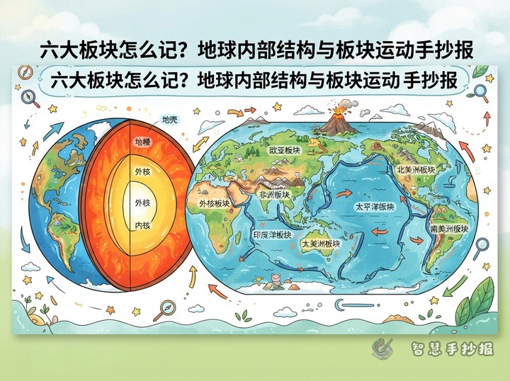
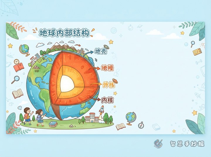
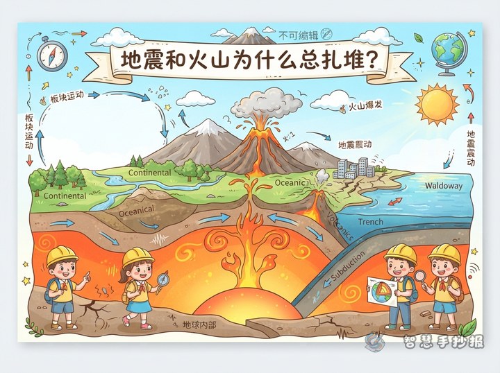
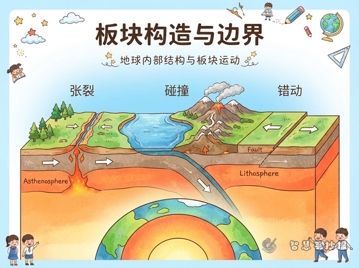
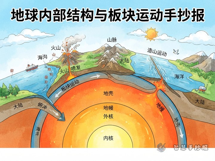
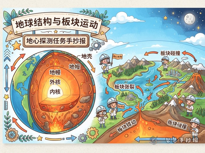
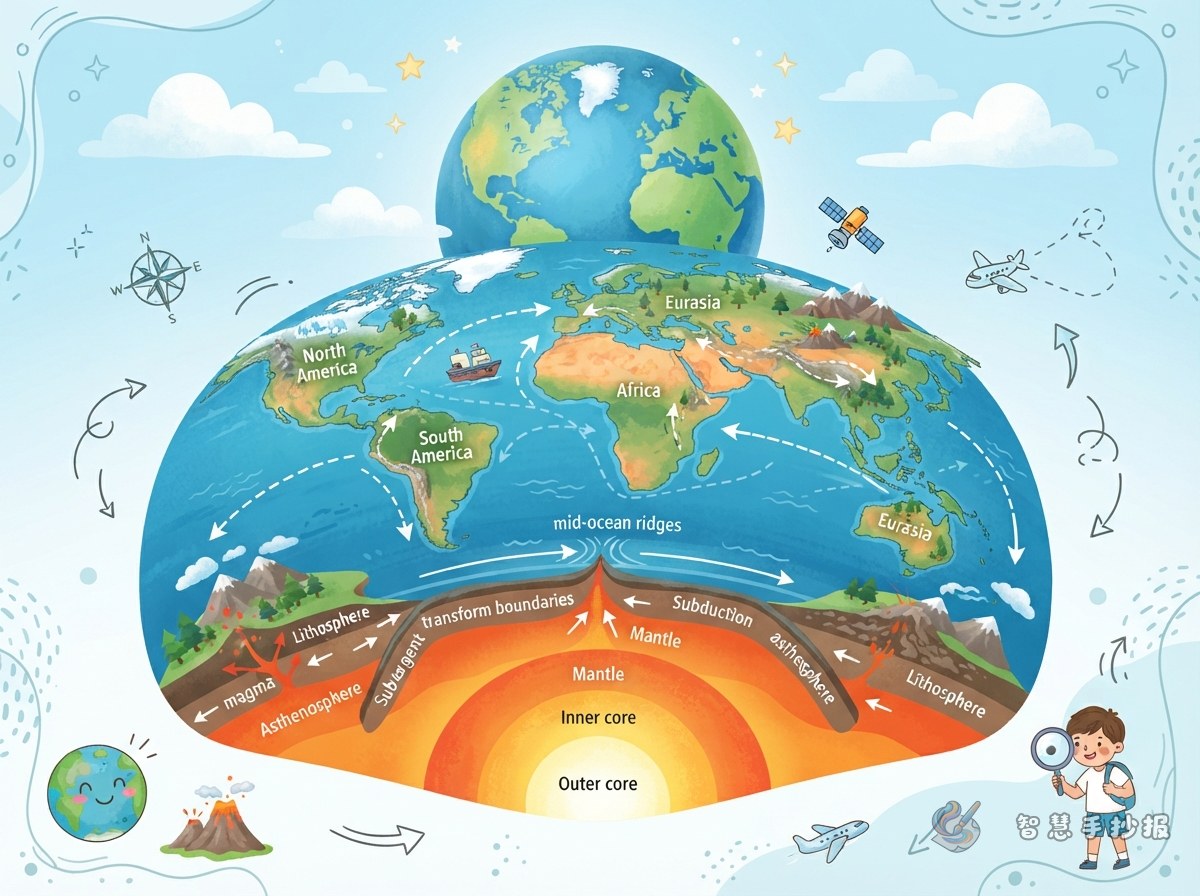
Continental drift offered important clues, while modern plate tectonic theory provides a broader explanation. From the outside inward, Earth can be introduced as the crust, mantle, and core. The crust and the rigid uppermost part of the mantle form the lithosphere, which is divided into many plates. Softer mantle material beneath the plates can flow slowly and forms part of the setting in which plate movement takes place.
Draw a vertical cross-section of Earth and label the crust, mantle, and core. Add puzzle-like arrows to show the movement of lithospheric plates. Remind readers that plate movement is extremely slow, so its changes are usually recognized through long-term observation.
Make the Evidence Chain the Main Layout Line
- Ask a question: Why do some continental outlines look similar?
- Look for evidence: Compare coastlines, fossils, rock layers, mountain ranges, and ancient climates.
- Form a hypothesis: The continents may once have formed one connected landmass before gradually separating.
- Add an explanation: Plate tectonic theory explains that lithospheric plates move slowly.
- Reach a conclusion: Earth’s map is not permanently fixed; it is part of a changing planet.
Draw this evidence chain as a horizontal timeline or a circular arrow. It will be clearer than placing unrelated facts together and will give the poster a strong central idea.
Finishing Touches for a Clear Science Poster
Place a continental puzzle map in the center, the four evidence cards on the left, and the Earth cross-section on the right. At the bottom, add a small section called “What I learned about science,” with a sentence such as “Observe first, compare carefully, and then suggest an explanation.” Use bold handwritten lettering for the title, keep each paragraph short, and highlight key terms with colored boxes.
To finish the page more efficiently, set up the map, evidence cards, and Earth cross-section first, then add borders and decorations. In the WeChat mini program “智慧手抄报,” you can continue arranging sections, adjusting the layout, and preparing a poster for printing or copying by hand.