Start with the Main Idea: One Line Splits North and South
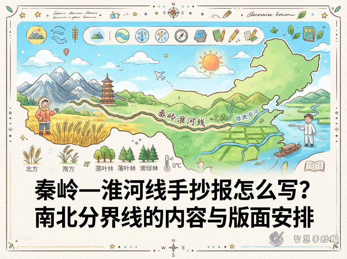
Before you draw anything, remember the key sentence: the Qinling-Huaihe line divides eastern China into a northern part and a southern part. It is more than a line on a map; it marks several geographic boundaries at once. Common examples include the January 0°C isotherm, the 800 mm annual rainfall line, the boundary between humid and semi-humid areas, the divide between subtropical and warm temperate zones, and the line between paddy fields and dry farmland. You do not need to include every term. Choose three to five you understand well and add simple drawings or colour blocks.
Six Kinds of Text Material You Can Use
If you are worried about running out of things to write, follow six threads: climate, rainfall, vegetation, farming, rivers and daily life.
- Climate: Northern winters are cold and dry, while southern winters are milder. Northern summers are hot and rainy, and southern summers are hot and wet.
- Rainfall: The 800 mm annual rainfall line runs roughly along the Qinling-Huaihe line, with less rain in the north and more in the south.
- Vegetation: The north is mainly deciduous broadleaf forest, while the south is mainly evergreen broadleaf forest.
- Farming: The north has more dry farmland and grows wheat and corn; the south has more paddy fields and grows rice.
- Rivers: Northern rivers carry less water, have shorter flood seasons and freeze in winter. Southern rivers carry more water, have longer flood seasons and usually do not freeze.
- Daily life: People in the north often eat wheat-based food, while people in the south often eat rice. Traditional northern houses have thicker walls and flatter roofs, while southern roofs are steeper for drainage.
How to Plan the Sections: Four Boxes Are Enough
Try not to use too many sections. Four or five works best. Here is one possible plan:
- Introduce the line: Use two or three sentences to explain where the Qinling-Huaihe line is and why it matters.
- North-south comparison cards: Use a table or two columns of small cards to compare temperature, rainfall, vegetation and farming.
- Geography notes: Add one or two details that are easy to miss, such as the fact that the Qinling Mountains form part of the watershed between the Yangtze and Yellow Rivers.
- Differences I have noticed: Write about north-south differences you have seen on a trip, read about, or heard from family. This makes the page feel personal.
Layout: Let One Line Divide the Page
This topic has a natural visual clue. Draw a diagonal, wavy or zigzag line from the top left to the bottom right, splitting the page into two halves.
- Write the north on the left side and the south on the right side, with the Qinling-Huaihe line in large letters in the middle.
- Mark the rough positions of the Qinling Mountains and the Huaihe River near the centre of the line, with small labels.
- Use different background colours, such as warm yellow for the north and light green for the south.
- Make the comparison boxes symmetrical so the page looks organised.
- Try a title such as One Line, Two Landscapes or China Along the North-South Divide.
Common Mistakes to Avoid
First, do not draw the Qinling-Huaihe line as a perfectly straight horizontal line. It runs east to west on a map, but the land it crosses is not flat. Second, do not pile up every boundary fact. Choosing three to five points and explaining them clearly is better than trying to cover everything. Third, avoid vague statements such as the north is cold and the south is hot. Adding the January 0°C isotherm and the 800 mm rainfall line makes the content more precise. Fourth, leave some space around the title and drawings so the page does not feel crowded.
From Draft to Final Copy
Sketch a simple layout on scrap paper first: a title area, the dividing line, two content areas on the left and right, and a small notes area at the bottom. Then sort your text into the sections. Shorten long sentences and turn short ones into key words. Finally, outline and colour with pens or pencils. If you want to save time on layout, you can open the WeChat mini program Smart Handwritten Newspaper to browse ready-made ideas on a China landscapes theme, then fill in your own text.